KONZA TECHNOLOGY CITY
PARKS AND OPEN SPACE DESIGN GUIDELINES
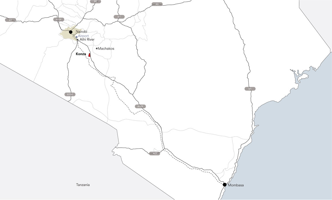
Konza Technology City is a flagship Kenya Vision 2030 project to advance growth and prosperity for Kenyans. Marketed as the new “Silicon Savanna”, the city is a strategic investment in Kenya’s growing ICT sector and when completed, will be home to leading companies in education, life sciences, telecom, and BPO/ITES. Envisioned as a world-class technology hub situated within the East African savanna, Konza merges the values of technology, sustainability, and local diversity. Didier Design Studio worked collaboratively with engineering firm Tetra Tech and OZ Architecture to develop the Parks and Open Space Design Guidelines for the Konza Technopolis Development Authority (KoTDA).
VISIT SIMILAR PROJECTS:
VISION
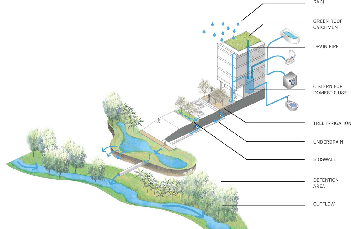
The vision for Konza’s Parks and Open Space integrates a wide range of diverse types of outdoor spaces staged within walking distance for city dwellers. The design guidelines and overall framework plan respond to the unique characteristics and constraints of the region -- particularly water scarcity, high average temperatures, and brief periods of extreme precipitation. The Konza Parks and Open Space strategy calls for an integrated stormwater management system, relies on native and drought-tolerant plants, and takes advantage of opportunities to increase urban biomass and mitigate heat island effects within the city. The overall vision is one that embraces sustainable growth while carefully considering local culture and ecology to foster a vibrant public realm with a unique sense of place.
LANDSCAPE TYPOLOGIES
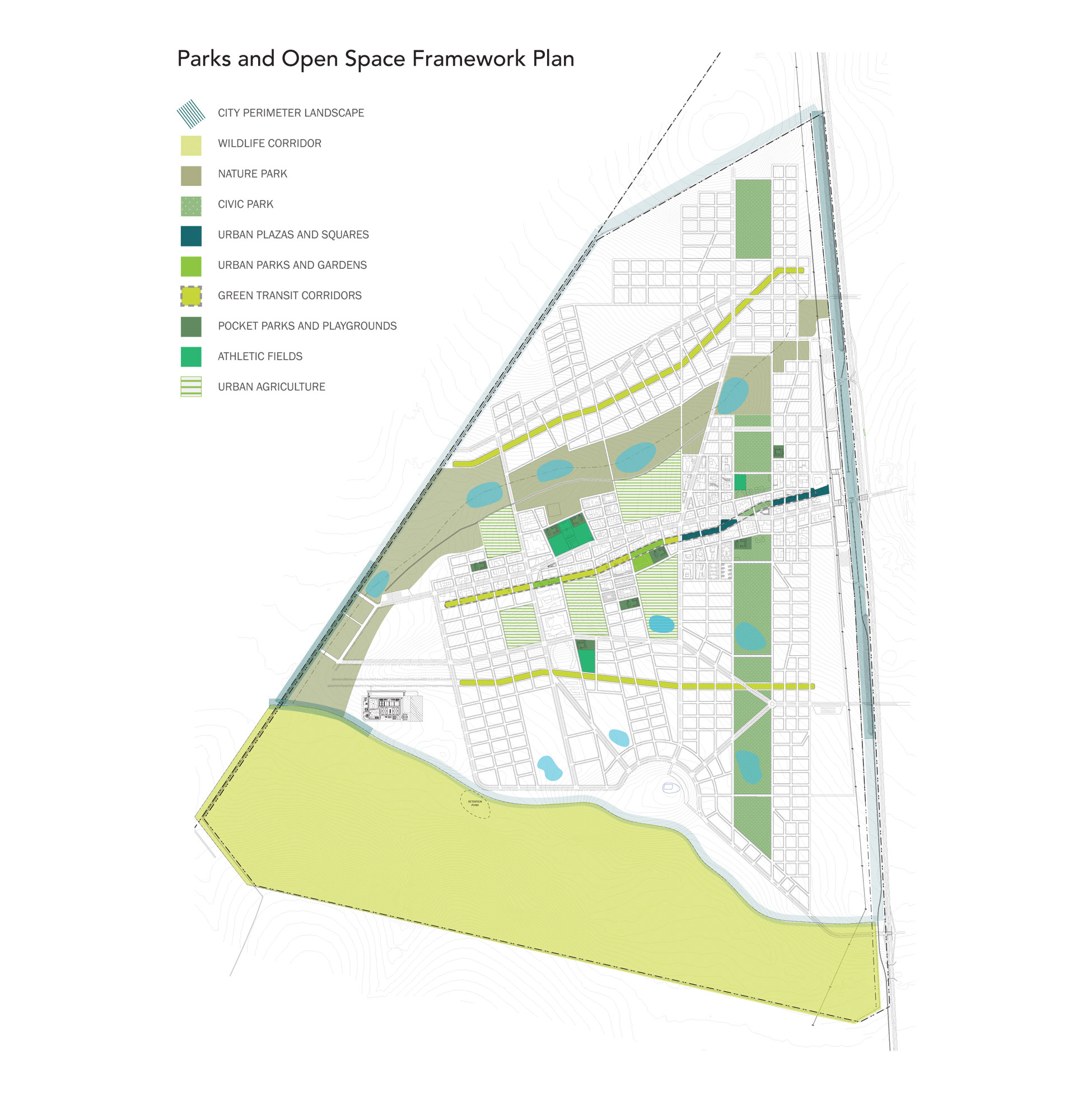
The Parks and Open Space Framework Plan provides a coordinated and well-defined layout and distribution landscape types within Konza Technology City. Informed by land use and the overall city master plan, each space is programmed in response to overall character, densities, and uses of adjacent city transect zones. The 10 distinct landscape typologies together comprise a diverse and cohesive system, offering park and plaza areas of high activity and multiple uses, as well as preserved open space in areas of less density or activity for urban agriculture, large recreational areas, and passive or restorative landscape areas to preserve native habitat and retain stormwater.
ACTIVE
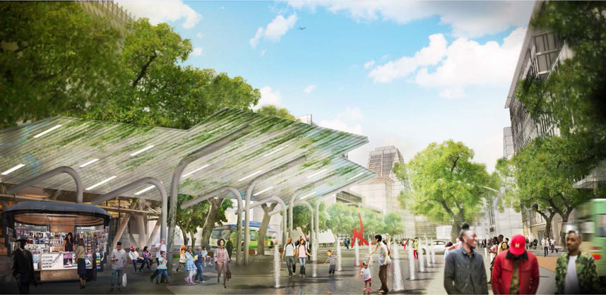
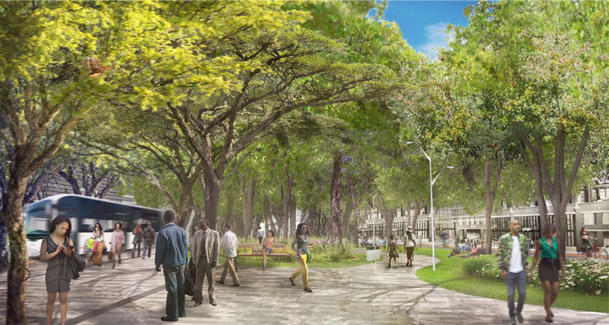
URBAN PLAZAS AND SQUARES are public spaces for leisure, gathering, and respite from bustling city streets. Located in dense urban areas near shops, restaurants, cafes, and offices, these spaces are active social nodes within the city.
URBAN PARKS AND GARDENS provide opportunities for immersion in spaces within the city that are centered on plants. Promoting health and well-being by offering opportunities for relaxation and connection to the natural world, they also offer climate regulating benefits by increasing urban biomass to mitigate heat island effects and provide cooling pockets within the city.
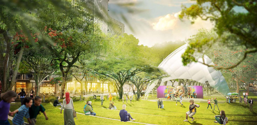
CIVIC PARK a continuous band of public space that links and extends significant public buildings and institutions, creating a physical and symbolic center for civic life. As the premier venue for large public events, gatherings and performances, Civic Park is a place for people to share in moments of connection to larger cultural, historical, or political facets of city life.
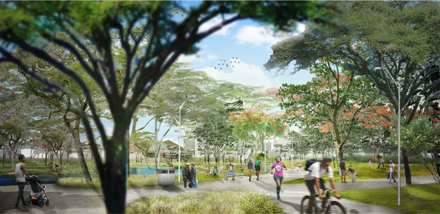
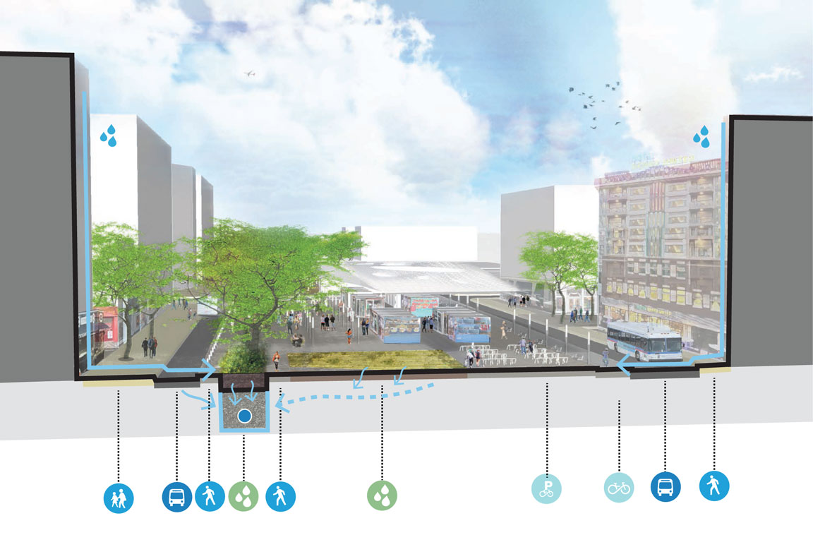
GREEN TRANSIT CORRIDORS are oriented along an east-west axis offering diverse social spaces and mixed-use development connected through multimodal transportation. They integrate public transit, bikeways, and pedestrian traffic with safe access for all users. Providing seating, shade, and planted areas, they also integrate raingardens to detain and filter urban stormwater.
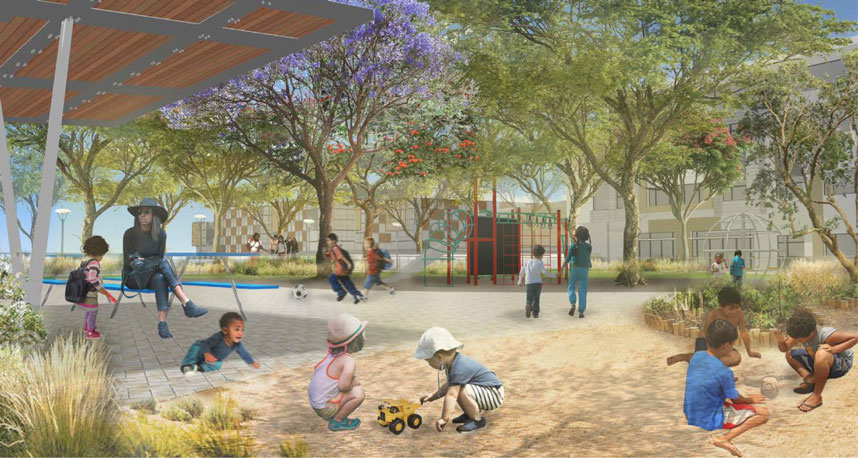
POCKET PARKS AND PLAYGROUNDS are community social centers; places for children to play and for neighbors and families to meet and greet. Small in scale and inserted within the city fabric, they provide direct access to the outdoors, thus enhancing psychological and physical health which is so essential to children’s development and general health.
PASSIVE
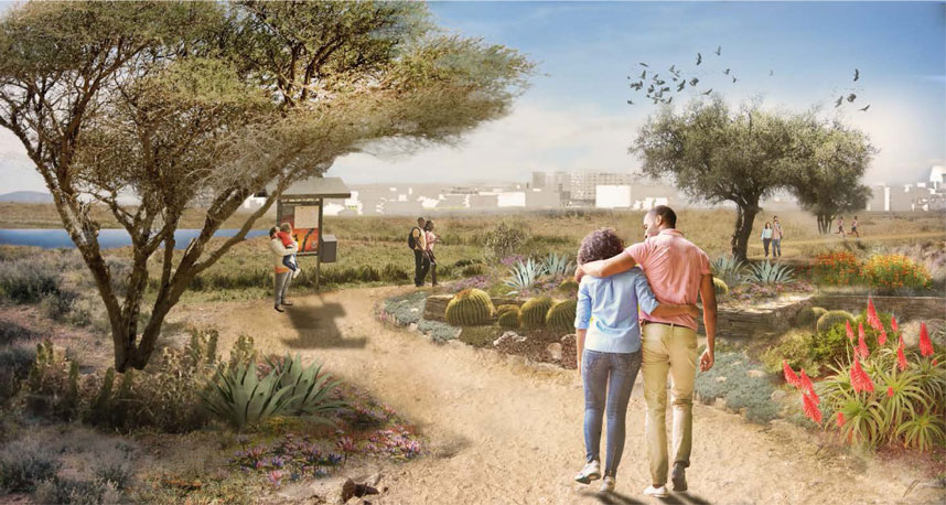
NATURE PARK acts as an urban savanna and nature preserve celebrating the existing native landscape. It provides opportunities for recreation and connection to a natural environment with trails and amenities such as seating, shade, and wayfinding signage. As a hybrid landscape serving conservation, recreation, education and habitat provision, Nature Park is the major point of connection between natural and cultural systems for Konza Technology City.
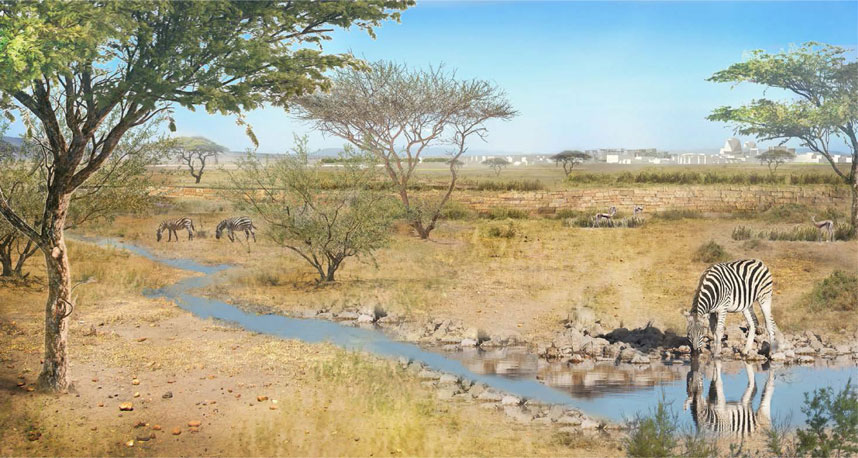
WILDLIFE CORRIDOR offers safe passageway for migratory animals, connecting to Kenya’s larger habitat network to promote biodiversity, protect animal habitats, and limit human / wildlife conflicts. The Wildlife Corridor will feature native plant material, a drainage swale for water, and a ha-ha wall to create opportunities for education and safe viewing/overlook of wildlife in native habitat.
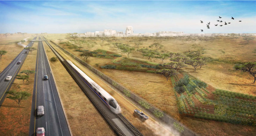
PERIMETER LANDSCAPE provides a secure city perimeter with sculptural planted berms, transitioning from open savannah to a more formalized character representational of Konza’s contemporary and influential infrastructure. A functional and aesthetic use of the excavated soil generated during the construction of Konza Technology City, they frame iconic city views upon approach, buffer highway sound, and prevent unauthorized vehicles and pedestrians from entering Konza.
RESILIENCE + SUSTAINABILITY
For a high-tech city built within the East African savanna, the overall Parks and Open Space system is essential to fostering a healthy, resilient, and livable urban environment. Designing landscapes that can perform many functions at once -- providing cleaner air, a cooler environment, absorbent pockets for stormwater, opportunities for recreation and relaxation -- will bring tremendous value to the future City of Konza.
SENSE OF PLACE
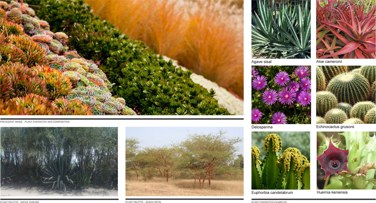
Parks and Open Spaces are composed with a selection of materials that tie to the broader regional context, and offer performative benefits such as water conservation and heat mitigation while creating a sense of identity that is unique to Konza. The planting concept advances the city’s overall sustainability initiatives through strategic use of available stormwater for irrigation, relying on mostly native and drought-tolerant species. Plant palletes are articultated in relation to land use and zones of densities within the city, making efficient use of water for irrigation. Priority is given to high density, mixed use areas and social nodes with bright, textured, ornamental planting. Broader, more remote landscapes rely on a xeric palette with native grasses, cactus, succulents, shrubs, and fewer trees. This strategy establishes a parallel between plant communities and social activities, using plants to articulate different zones within the city and further enhance a sense of place.